


BackCountry Navigator XE
Topo
Описание BackCountry Navigator XE: Topo
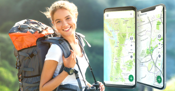
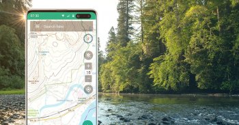
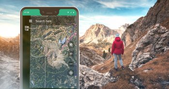
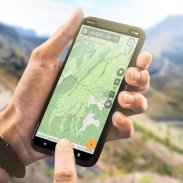
Загрузите и используйте топографические карты в автономном режиме, чтобы исследовать природу с помощью своего смартфона! Используйте GPS в своем смартфоне для навигации, отмечайте свой путь и записывайте путевые точки.
Посмотрите на преимущества, которые дает BackCountry Navigator XE.
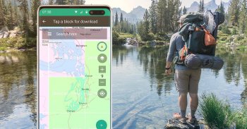
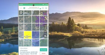
Простая загрузка карт на основе сетки
Вы можете попробовать более простой подход к загрузке и организации офлайн-карт, выбирая большие квадраты за раз. Визуализируйте, что у вас есть и что вам нужно.
У нас есть множество карт мира и страны, которые можно загрузить для использования в автономном режиме на основе годового членства.
Бронзовое членство для использования большинства карт.
Серебряное членство также позволяет использовать топографические карты США с затенением склонов, а также карты Лесной службы США.
Золотое членство также позволяет использовать карты Accuterra Maps с новыми удобочитаемыми картами США и мира, а также базовую карту BackRoads MapBook в Канаде.
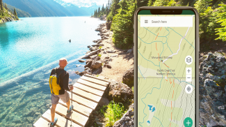
Векторные топографические карты мира
Карта по умолчанию, BackCountry World map, представляет собой набор векторных топографических карт мира. Векторные мозаичные карты обещают четкую многоуровневую детализацию с возможностью быстрой и компактной загрузки больших фрагментов земной поверхности. Топографическую карту мира BackCountry можно просмотреть в этом приложении и на сайте
bcnavxe.com
, причем их можно легко установить большими блоками.
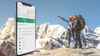
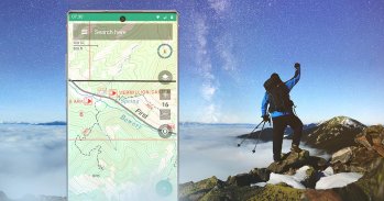
GPS-навигация
Используя GPS в современном смартфоне, смотрите свое положение на движущейся офлайн-карте. Найдите свой путь к путевым точкам, которые вы отмечаете на карте или создаете, вводя координаты в строку поиска.
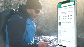
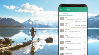
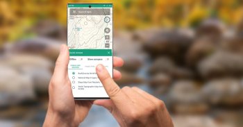
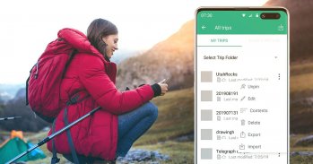
Планирование в облаке
Веб-сайт
bcnavxe.com
— это веб-интерфейс для BackCountry Navigator XE. С его помощью вы можете прокладывать точки, маршруты и границы для поездок и загружать их по запросу в мобильное приложение. Вы также можете отправлять поездки, созданные в мобильном приложении, в облако для просмотра или публикации.
Кроссплатформенность
BackCountry Navigator XE работает на Android, имеет более новое приложение для iOS и веб-приложение для помощи в планировании на
bcnavxe.com
.
Приложение iOS доступно в
Appstore
.
Мы хорошо известны нашим предыдущим продуктом
BackCountry Navigator PRO
, который все еще поддерживается и развивается параллельно.
https://play.google.com/store/apps/details?id=com.crittermap.backcountrynavigator.license
Чтобы понять, почему вы можете захотеть перейти на XE с PRO, см. это
сравнение
.
Вы также можете подписаться на список XE, чтобы получать уведомления о статусе, обновлениях и предложениях.
BackCountry Navigator XE: Topo - Версия 3.1.8
(19-11-2024)BackCountry Navigator XE: Topo - Информация об APK
Версия APK: 3.1.8Пакет: com.crittermap.backcountrynavigator.xeПоследняя версия BackCountry Navigator XE: Topo
Другие версии


Приложения в этой категории

Вам также могут понравиться...


